 DONATE


The Indy Connect studies of the Red and Blue Rapid Transit lines are in. The Indianapolis Regional Transportation Council heard the recommended alternatives at a meeting this morning.
Recommendations for the 25-mile long Red Line, which runs north and south, between Carmel and Greenwood, call for 30 to 40 bus rapid transit stations along the entire route. Stops located north of 38th Street and south of South Street would be situated approximately every mile. Between 38th Street and South Street the stops would be placed approximately every half-mile.
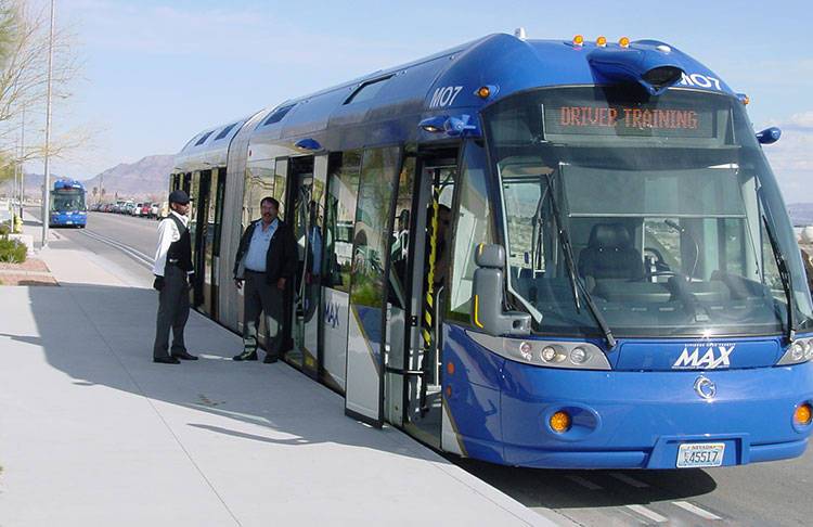
Bus rapid transit vehicles, which look, operate and feel like a light rail vehicle, but without the tracks, is the recommended vehicle for the Red line.
The 24-mile long Blue Line will be a bus rapid transit service that runs east and west between Cumberland and the Indianapolis International Airport through downtown Indianapolis. The route primarily uses Washington Street, with 32 stations spaced approximately every half-mile to mile along the route.
The next phase of the planning process is an environmental review.
The Indy Connect plan will be shared with the public during an open house on Nov. 14 between 11:30 a.m. and 1:30 p.m. at the Indianapolis Artsgarden.
Separate from the Indy Connect planning process, the Central Indiana Transit Study Committee is looking at the funding issue. Its next meeting is Oct. 31 at 9 a.m. at the Indiana Statehouse.

 Support WFYI. We can't do it without you.