 DONATE

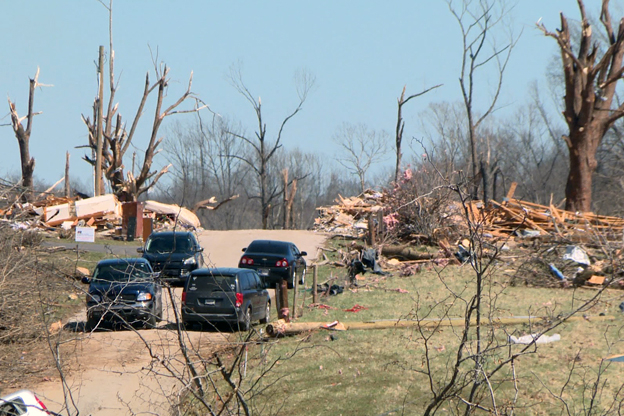
An EF-3 tornado touched down in McCormick’s Creek State Park and continued northeast into Owen and Monroe counties Friday.
Devan Ridgway/ WFIU/WTIU NewsA strong storm system is expected to bring showers and thunderstorms and a chance of severe weather to most of the state Wednesday.
National Weather Service meteorologist Andrew White says storms could start as late as tonight, but the better chance for severe weather will be Wednesday morning through the evening.
“We do think the most likely thing is going to be a combination of damaging winds and hail," White said. "The tornado threat is certainly there. But it's not what we were looking at with the last event. We're not expecting a widespread tornado outbreak.”
He says the timing is uncertain but severe weather is possible Wednesday from 10 a.m. through 2 p.m. and then again from 3 p.m. until 7 p.m.
White says survey teams identified another tornado from Friday night’s storms in Montgomery and Boone counties bringing the total to 10 in the Indianapolis region – and 20 for the state.
That's the latest number we have. So that you know what's definitely one of the bigger events we've had in recent memory,” he said.
Daytime highs could reach 81 degrees Tuesday then fall to the mid-50s by Thursday.


 Support WFYI. We can't do it without you.